Topographic & Scanning
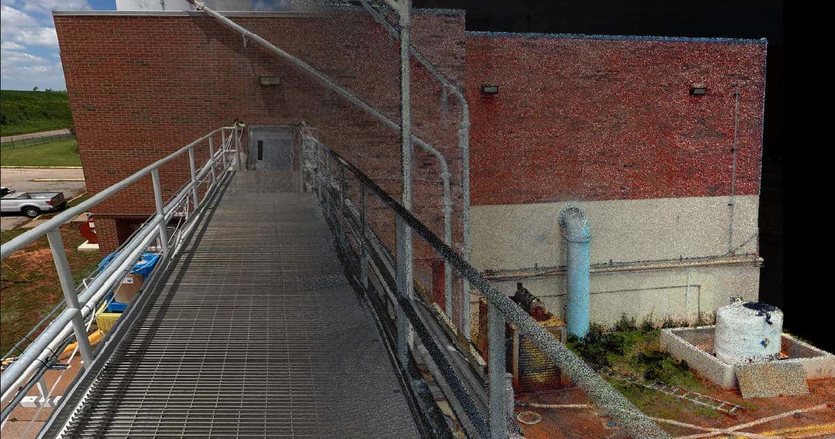
TERRESTRIAL SCANNING
Terrestrial 3D scanning in land surveying involves using advanced laser technology to capture detailed three-dimensional images of structures, terrain, and environments. This method provides highly accurate construction, architectural planning, and historic preservation data. Terrestrial scanning delivers precise measurements and comprehensive models of complex geometries and landscapes. The technology is invaluable for documenting as-built conditions, monitoring structural integrity, and planning renovations. Additionally, it facilitates the creation of digital twins for simulations and analyses, ensuring projects are executed with high accuracy and efficiency.
TOPOGRAPHIC SURVEYS
Topographic surveys are essential for identifying and mapping the ground's contours and existing features on the earth's surface. They provide critical data for planning construction projects, environmental management, and land development strategies. By capturing the elevation and position of natural and man-made features, topographic surveys enable engineers, architects, and planners to design with precision. This method supports site analysis, drainage planning, and landscape design, ensuring that projects align with the natural terrain and comply with regulatory requirements. The detailed maps produced are invaluable for making informed decisions in various phases of development and environmental conservation.
drone lidar surveys
Drone LiDAR surveys utilize cutting-edge drone technology with LiDAR sensors to capture high-resolution, three-dimensional data of large areas. This method offers unparalleled precision and efficiency in mapping terrain, vegetation, and structures. Ideal for topographic surveys, forestry, and infrastructure monitoring, drone LiDAR provides accurate elevation models and detailed spatial information. The mobility and versatility of drones make this approach particularly effective for accessing difficult or hazardous locations and ensuring comprehensive data collection for construction, environmental studies, and land management projects.