BOUNDARY SURVEY

Professional Boundary Surveys

Land surveying has a long history that dates back thousands of years. From the Eqyptians in 3000 B.C.E., developing boundary survey techniques to restore plots of land after floods, to George Washington and Thomas Jefferson surveying the early parts of Virginia, land surveying has played a critical role for humanity. Stable land boundaries are an important part of the fabric of the United States. Home and land ownership are a significant portion of individual and intergenerational wealth. A boundary survey completed by a licensed professional land surveyor is one way to help protect that.

Why do I Need a Boundary Survey?

Land Survey Map

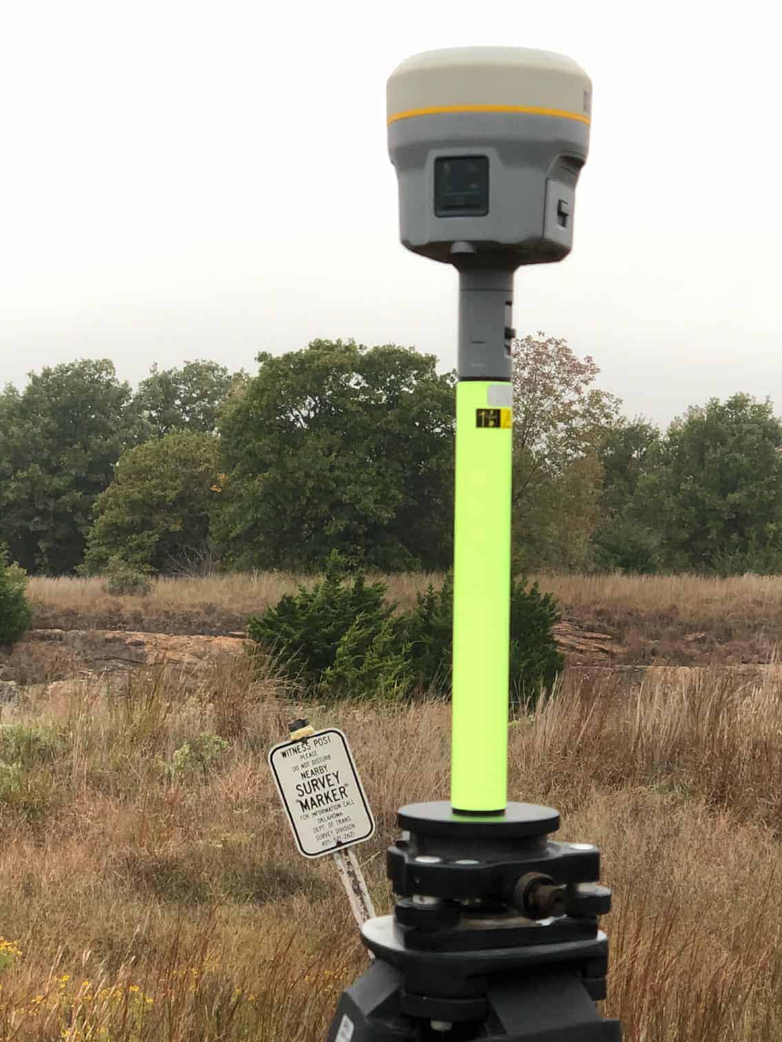
If you're in the process of purchasing or selling a parcel of land, you'll likely need a boundary survey. Surveys are recommended before the transfer of property ownership because they identify the conditions on the ground. These conditions combined with the provided parcel title work help the licensed surveyor complete a plat identifying what they find.

Surveying the parcel before these activities ensures that the expense and frustration of defending a possible lawsuit, moving a building, or resolving a boundary dispute can be avoided. A property or boundary survey differs from a Mortgage Inspection Report, which is designed to be a true representation of the conditions that were found at the time of inspection and are based on record or deed.

According to the Oklahoma Society of Land Surveyors (OSLS), boundary surveys are the most common and serve to locate a certain property's limits or description. After the survey is completed, a licensed land surveyor will review the field data and create a drawing called a plat that is signed and sealed. Sometimes there may be ambiguity that needs to be clarified, and a second trip to the site will occur. It is important to have an experienced professional complete your survey, as measurements need to be as exact as possible.

The drawing may include:

  • Lot dimensions - The dimensions of a lot come from deed, subdivision plats, and survey drawings. They show the exact lines of the property. You can choose to have a boundary survey include any improvements made on the land by previous owners.
  • Improvements could include houses, sheds, garages, pools, and other permanent changes to the property.
  • Fences are shown on plats and their relation to the calculated property line.  They are typically not built directly on the property lines and  should not be taken as the outlines of the parcel.

What's a Boundary Survey?

Image

What's a Boundary Survey?

Image

According to the Oklahoma Society of Land Surveyors (OSLS), boundary surveys are the most common and serve to locate a certain property's limits or description. After the survey is completed, a licensed land surveyor will review the field data and create a drawing called a plat that is signed and sealed. Sometimes there may be ambiguity that needs to be clarified, and a second trip to the site will occur. It is important to have an experienced professional complete your survey, as measurements need to be as exact as possible.

The drawing may include:

  • Lot dimensions - The dimensions of a lot come from deed, subdivision plats, and survey drawings. They show the exact lines of the property. You can choose to have a boundary survey include any improvements made on the land by previous owners.
  • Improvements could include houses, sheds, garages, pools, and other permanent changes to the property.
  • Fences are shown on plats and their relation to the calculated property line.  They are typically not built directly on the property lines and  should not be taken as the outlines of the parcel.

What's the Boundary Survey Process?

Survey Marker

A boundary survey is a meticulous process, and the task of defining boundaries should be taken seriously. Each survey is different, but the general steps for completing a property survey are listed below:

  • Deed and other record research
  • Planning and organizing the field work
  • Completing the associate field work at the site
  • Reviewing and harmonizing the field work with the record legal description
  • Preparing and reviewing an official plat
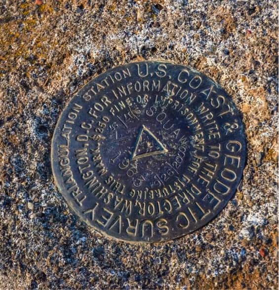
  • Setting the property corners referenced on the plat
  • Completing the official plat

A poorly conducted survey can have serious consequences now, and in the future. The process of completing a boundary survey is meticulous. As many professional websites mention, defining boundaries is an important legal task that professionals take seriously. Once filed, a boundary survey is a legal document, so it must be completed carefully by a licensed professional. If your neighborhood or property experienced a poor boundary survey the consequences could include:

  • Potential title defects deeds and transfer of ownership
  • Adjacent landowners disputing property and fence line
  • Violation of local codes concerning building lines or improvements to the parcel
  • Other unknown issues regarding the property

Do I Really Need a Boundary Survey?

Survey Marker

Do I Really Need a Boundary Survey?

Survey Marker

A poorly conducted survey can have serious consequences now, and in the future. The process of completing a boundary survey is meticulous. As many professional websites mention, defining boundaries is an important legal task that professionals take seriously. Once filed, a boundary survey is a legal document, so it must be completed carefully by a licensed professional. If your neighborhood or property experienced a poor boundary survey the consequences could include:

  • Potential title defects deeds and transfer of ownership
  • Adjacent landowners disputing property and fence line
  • Violation of local codes concerning building lines or improvements to the parcel
  • Other unknown issues regarding the property

How Much Does a Boundary Survey Cost?

The cost of a property survey is different for each project a can vary based on several factors.  Some of the details a surveyor will utilize to determine pricing are listed below:

  • The location, accessibility, and ruggedness of the parcel of land you want surveyed.  Dense brush, heavy trees, and uneven terrain slow down the field work process.
  • The shape and size of the surveyed parcel of land.   A large parcel with a significant amount of terrain will take more time.  The more calls in a metes and bounds description, the more lines a surveyor has to retrace in the field.
  • Temperature.  Land surveyors work year round, so temperatures can affect how much a crew can complete in a day.  The hotter it is, the more breaks need to be taken to ensure the safety of personnel.
  • "Riparian Rights" or issues arising from properties along water. Water boundaries along a parcel introduce a higher level of initial research, more field work, and additional project review.
  •  

Boundary Survey Plat Examples

Quote

Your Name(Required)
Your Email Address(Required)
Survey Location / Address
This field is for validation purposes and should be left unchanged.

Quote

Your Name(Required)
Your Email Address(Required)
Survey Location / Address
This field is for validation purposes and should be left unchanged.