A survey "Retracement"...
is at the heart of completing a boundary survey. In today's world of GPS, most people aren't aware that these types of measurements were not as achievable when many land surveys were originally completed. GPS and other measurements (metes) are very important to the survey profession, but more often than not, in retracing a survey, the monumentation (bounds) are weighted of higher importance. This, included with many ambiguities in title and field evidence, demonstrates the value that a land surveyor brings to identifying your boundary.
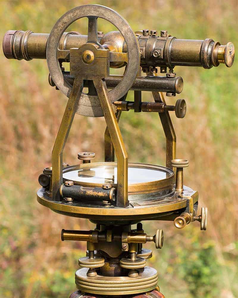
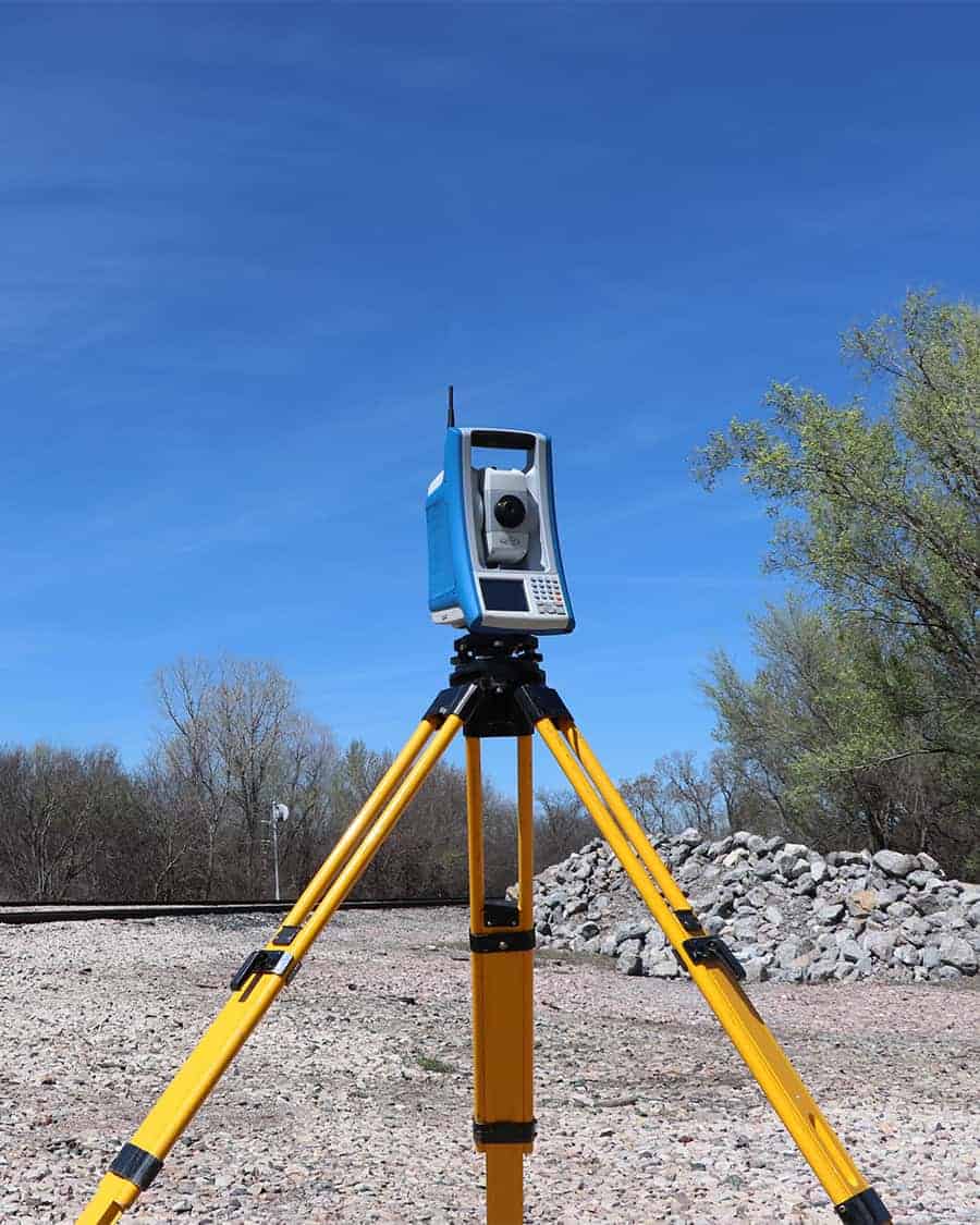
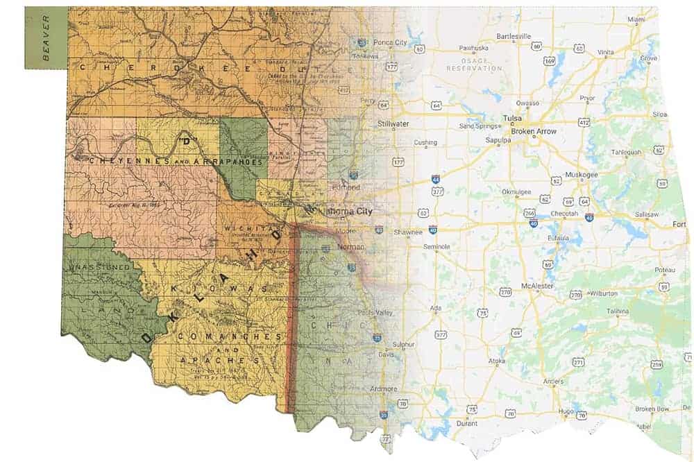
The tools of the survey trade in Oklahoma for subdividing land into sections, townships, and ranges included chains of 66 feet, commonly called a "Gunter's Chain" for measurements, and magnetic needle, solar compass, or transit with solar attachment for astronomic or magnetic bearings (directions). Today, surveyors are using instruments that provide a higher level of precision than was achievable at that time. A good example of this, is the robotic total station shown below.

A survey "Retracement"...
is at the heart of completing a boundary survey. In today's world of GPS, most people are not aware that these types of measurements were not as achievable when many land surveys were originally completed. GPS and other measurements (metes) are very important to the survey profession, but more often than not, in retracing a survey, the monumentation (bounds) are weighted of higher importance. This, included with many ambiguities in title and field evidence, demonstrates the value that a land surveyor brings to identifying your boundary.
The tools of the survey trade in Oklahoma for subdividing land into sections, townships, and ranges included chains of 66 feet, commonly called a "Gunter's Chain" for measurements, and magnetic needle, solar compass, or transit with solar attachment for astronomic or magnetic bearings (directions). Today, surveyors are using instruments that provide a higher level of precision than was achievable at that time. A good example of this, is the robotic total station shown below.


Boundary laws...
are typically built around the concept that no measurement is exactly repeatable and that bounds, such as property or section corner monuments, hold rather than metes. Even though measurements have become more repeatable, improper use of equipment, equipment of varying precisions, improperly monumented corners and human error still need to be navigated by a land surveyor. This is why it is important to have a professional survey team retrace the boundary for your property.
Surveyors will use today's latest technology for measurements, but their experience and education on retracement is what is most important to ensure you have accurate boundaries defined.
Some other items a surveyor will review, include:
- Right of Possession
- Junior / Senior Rights
- Riparian Boundaries
- Written Intent of Parties

Boundary laws...
are typically built around the concept that no measurement is exactly repeatable and that bounds hold rather than metes. Even though measurements have become more repeatable, improper use of equipment, equipment of varying precisions, improperly monumented corners and human error still need to be navigated by a land surveyor. This is why it is important to have a professional survey team retrace the boundary for your property.
Surveyors will use today's latest technology for measurements, but their experience and education on retracement is what is most important to ensure you have accurate boundaries defined.
Some other items a surveyor will review, include:
- Right of Possession
- Junior / Senior Rights
- Riparian Boundaries
- Written Intent of Parties
As you can see, determining a boundary, can be a daunting task. Gateway's land survey team works hard to ensure that all of the proverbial "I's" are dotted, and "T's" are crossed. Lastly, we know that a good customer experience is of the utmost importance, which is why we focus on communication from day one.
A Mortgage Inspection is Not a Boundary Survey
One other thing to consider is that a mortgage inspection is not a boundary survey. Per the Oklahoma State Board of Licensure for Professional Engineers and Land Surveyors; a mortgage inspection report is not to be relied upon for the establishment of fence, building or other future improvement lines. A mortgage inspection certificate is a representation of the conditions that were found at the time of inspection and should not be construed as a boundary survey.
If you are in the process of purchasing or selling a parcel of land, you will likely need a boundary survey. In the event you are subdividing, improving, or building on land it is also recommended to have a certified boundary survey. It is always important to ensure that you are utilizing the services of a licensed professional land surveyor when determining boundaries on your property.
A Mortgage Inspection is Not a Boundary Survey
One other thing to consider is that a mortgage inspection is not a boundary survey. Per the Oklahoma State Board of Licensure for Professional Engineers and Land Surveyors; a mortgage inspection report is not to be relied upon for the establishment of fence, building or other future improvement lines. A mortgage inspection certificate is a representation of the conditions that were found at the time of inspection and should not be construed as a boundary survey.
If you are in the process of purchasing or selling a parcel of land, you will likely need a boundary survey. In the event you are subdividing, improving, or building on land it is also recommended to have a certified boundary survey. It is always important to ensure that you are utilizing the services of a licensed professional land surveyor when determining boundaries on your property and we would love the opportunity to earn your business.
Need Assistance?
Please fill out the form below and provide as much detail regarding questions, and or projects as you can.
Need Assistance?
Please fill out the form below and provide as much detail regarding questions, and or projects as you can.

