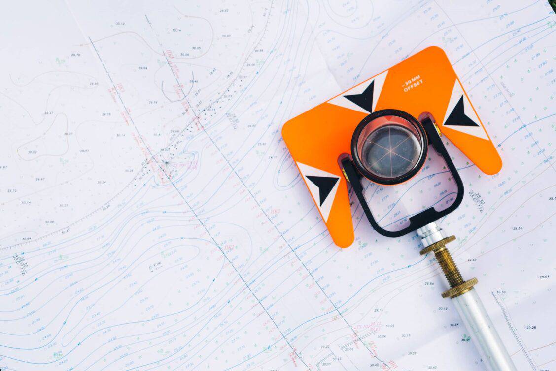
I keep my blog posts to approximately 600 words or less. Land surveying can be challenging to communicate and sometimes weigh heavy on the audience's eyelids. Sometimes I find my wife dozing off as I tell her how excited I am that we found an original stone corner.
This post will be longer so that I can explain the process and give some examples to help you understand the process of a site plan survey.
So What is a Site Plan Survey?
I keep my blog posts to approximately 600 words or less. Land surveying can be challenging to communicate and sometimes weigh heavy on the audience's eyelids. Sometimes I find my wife dozing off as I tell her how excited I am that we found an original stone corner.
This post will be longer so that I can explain the process and give some examples to help you understand the process of a site plan survey.

So What is a Site Plan Survey?
Generally, a boundary survey, or pin survey, involves investigating, collecting, and evaluating "real property" evidence from recorded, field, and other relevant sources.
The licensed surveyor will formulate a professional opinion regarding the location of property boundaries, set or confirm existing monuments, and communicate that via a boundary survey plat.

Land Surveys Require Thorough Research
As you can see, a significant amount of fieldwork, cost, training, and equipment goes into generating a professional boundary opinion. Land surveyors take this very seriously and are charged with doing so by the State in which they're licensed.
According to the Oklahoma Real Estate Commission, a mortgage inspection report is "A representation of the boundaries of a parcel of real property and the improvements thereon and shall not be designated as or construed as being a land or boundary survey." Both of these services are valuable in home or land purchases, but they are also different products. I discussed the main differences between boundary surveys and mortgage inspection reports in more detail in a previous blog post, "Why is a Boundary Survey more Expensive than a Mortgage Inspection Certificate."
Professional survey grade equipment that stands up to tough field conditions is an expensive investment for survey companies and land surveyors.
Upon leaving the courthouse, I decided to take a trip to the Territory Museum in Guthrie to see if they had any old maps of the city. Old maps that can be used to confirm record data are useful in situations like this. The staff at the museum was extremely helpful, and if you haven't been, it is a beautiful testament to the history of our state. The insurance maps that I took pictures of while at the museum were helpful and I decided to download copies from the Library of Congress for future reference.
The Oklahoma Department of Transportation (ODOT) completes land surveys on their highway projects. This site plan survey was near a state highway and I was able to request plans that had survey information surrounding the location.
Once I completed the preliminary research, I downloaded the Oklahoma Certified Corner Records and original GLO records. I combined this with all the record research and prepared a plan for the crew chief. The fieldwork plan included these details and the requirements the client, architect, and contractor communicated. A site plan survey differs from a typical boundary survey because we add topographic features based on the project's needs. I always ensure that our crew chief understands what the client requires for site design so they can collect all relevant evidence on the ground for the survey's boundary and topographic aspects. Some examples of topographic measurements taken in the field include a grid topo, existing fiber optic lines, underground electric lines, existing pipelines, overhead powerlines, power poles, and sanitary and storm sewers. Many other items are measured during the land survey, but this is an excellent example of common items.
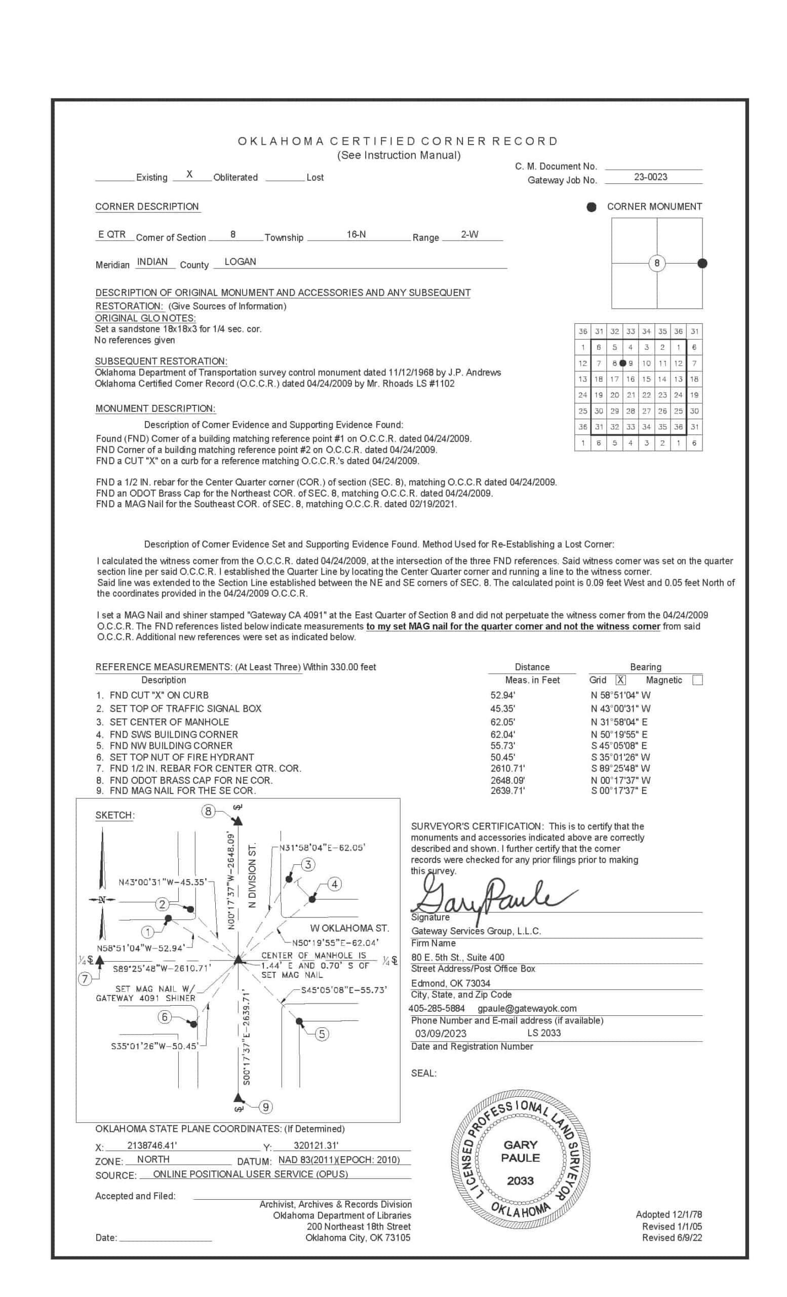
Once I completed the preliminary research, I downloaded the Oklahoma Certified Corner Records and original GLO records. I combined this with all the record research and prepared a plan for the crew chief. The fieldwork plan included these details and the requirements the client, architect, and contractor communicated. A site plan survey differs from a typical boundary survey because we add topographic features based on the project's needs. I always ensure that our crew chief understands what the client requires for site design so they can collect all relevant evidence on the ground for the survey's boundary and topographic aspects. Some examples of topographic measurements taken in the field include a grid topo, existing fiber optic lines, underground electric lines, existing pipelines, overhead powerlines, power poles, and sanitary and storm sewers. Many other items are measured during the land survey, but this is an excellent example of common items.

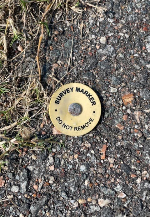
We found survey monuments to the North of the subject parcel, and I contacted the firm that completed the survey. They were helpful and provided me with the plat they completed. I used that data as additional evidence for the boundary survey portion of my project. All land surveyors put the protection of the public at the forefront of our minds when completing projects. Site plan surveys like this one, which have ambiguity with record data, make it difficult to derive at a simple boundary line solution. However, when a surveyor has record evidence, ODOT plans, historical maps, surveyor's plats, and detailed field evidence, it can assist with making the decision easier.
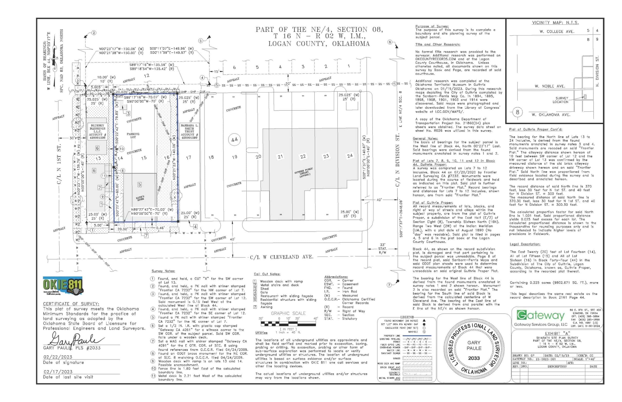
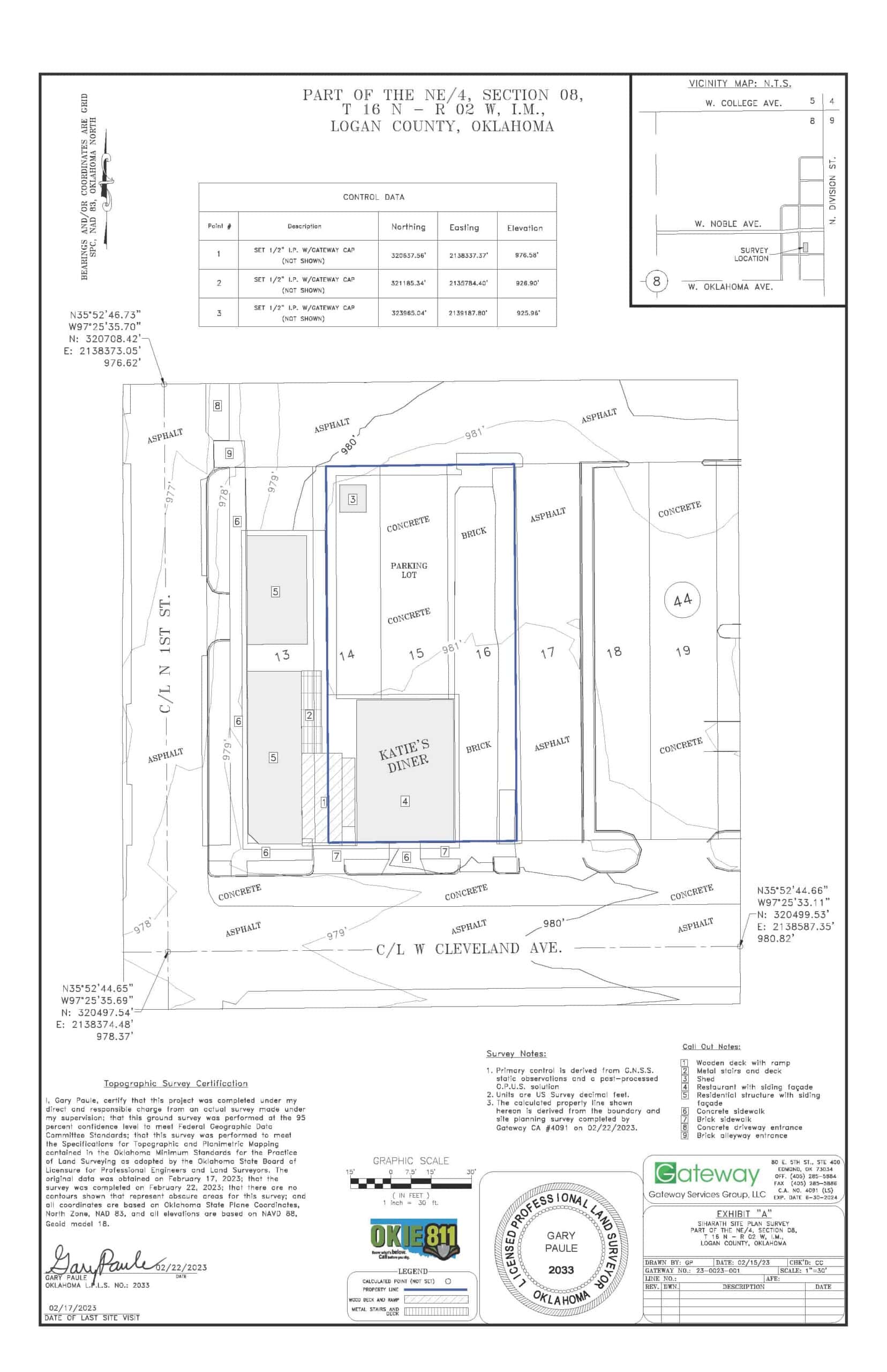
While detailed fieldwork and research are crucial, their value is ultimately realized only if the final plat is presented in a clear and concise manner. Site plan surveys involve integrating various survey types into one cohesive document, requiring considerable effort on the part of the professional surveyor to make it easily understandable. On this particular project, the map scale, or how large the subject parcel is on the sheet of paper, was a difficult decision.
I wanted to show a larger portion than the subject parcel because of sewer lines North of the property and potential stormwater management issues. I ultimately decided at 1" = 40' on an 11"x17" sheet size. This presented a "happy medium" between the topographic and boundary surveys. To comply with the Oklahoma Minimum Standards of Surveying, we must meet specific standards on boundary surveys and topographic maps displaying contour lines.
I platted a second sheet to show the contour lines because it made it difficult to see the details of utilities, spacing between buildings, and the locations of existing brick sidewalks and driveways. These additional topographic details are a few of the items the client's team communicated as important to their project. The final step for me in a site plan survey is to file my Oklahoma Certified Corner Records as required by the state minimum standards. I'll dedicate a future blog post to this subject so that process is better understood.
I'm proud of our effort in completing this project. It required more fieldwork, research, and professional survey time than we accounted for. My grandparents taught me that "If we put our names on it, we need to be proud of what we did." Every time I complete a survey plat, I think about the importance of that. It's more than just complying with state and local minimum standards; it's about turning out the best product we can and improving upon that each time.
We found survey monuments to the North of the subject parcel, and I contacted the firm that completed the survey. They were helpful and provided me with the plat they completed. I used that data as additional evidence for the boundary survey portion of my project. All land surveyors put the protection of the public at the forefront of our minds when completing projects. Site plan surveys like this one, which have ambiguity with record data, make it difficult to derive at a simple boundary line solution. However, when a surveyor has record evidence, ODOT plans, historical maps, surveyor's plats, and detailed field evidence, it can assist with making the decision easier.

While detailed fieldwork and research are crucial, their value is ultimately realized only if the final plat is presented in a clear and concise manner. Site plan surveys involve integrating various survey types into one cohesive document, requiring considerable effort on the part of the professional surveyor to make it easily understandable. On this particular project, the map scale, or how large the subject parcel is on the sheet of paper, was a difficult decision.
I wanted to show a larger portion than the subject parcel because of sewer lines North of the property and potential stormwater management issues. I ultimately decided at 1" = 40' on an 11"x17" sheet size. This presented a "happy medium" between the topographic and boundary surveys. To comply with the Oklahoma Minimum Standards of Surveying, we must meet specific standards on boundary surveys and topographic maps displaying contour lines.
I platted a second sheet to show the contour lines because it made it difficult to see the details of utilities, spacing between buildings, and the locations of existing brick sidewalks and driveways. These additional topographic details are a few of the items the client's team communicated as important to their project. The final step for me in a site plan survey is to file my Oklahoma Certified Corner Records as required by the state minimum standards. I'll dedicate a future blog post to this subject so that process is better understood.


I'm proud of our effort in completing this project. It required more fieldwork, research, and professional survey time than we accounted for. My grandparents taught me that "If we put our names on it, we need to be proud of what we did." Every time I complete a survey plat, I think about the importance of that. It's more than just complying with state and local minimum standards; it's about turning out the best product we can and improving upon that each time.
Need Assistance?
Please fill out the form below and provide as much detail regarding questions, and or projects as you can.
Need Assistance?
Please fill out the form below and provide as much detail regarding questions, and or projects as you can.

