
Principles of LiDAR
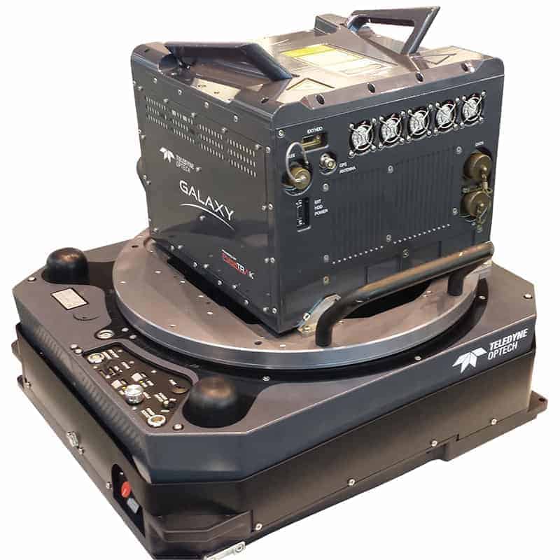
A typical LiDAR system consists of three key components:
- Laser Scanner - A laser scanner emits rapid light pulses towards the target area. These pulses bounce back after hitting various surfaces, such as the ground, buildings, vegetation, or any other object in its path.
- Global Navigation Satellite System (GNSS) Receiver - GNSS receivers provide accurate positioning data, enabling the LiDAR system to determine its location on the Earth's surface.
- Inertial Measurement Unit (IMU) - The IMU records the orientation and motion of the LiDAR system, which is critical for accurately georeferencing the captured data.
Data Acquisition and Point Cloud Generation
The Multifaceted Applications of LiDAR
LiDAR's ability to capture precise and comprehensive 3D data has led to widespread adoption across various industries. Let's delve into some of its key applications:
- Environmental Monitoring and Conservation - Scanning is instrumental in studying and monitoring natural environments. It aids in assessing forest health, measuring vegetation density, monitoring elevation changes, and even tracking wildlife populations. For conservationists, LiDAR provides valuable insights into habitat health and biodiversity, helping to develop effective conservation strategies.
- Urban Planning and Infrastructure Development - LiDAR assists city planners and civil engineers in creating highly detailed 3D models in urban areas. These models comprehensively view existing structures, terrain, and infrastructure. Urban planners can utilize this data for efficient land use planning, infrastructure development, and disaster preparedness.
- Archaeology and Cultural Heritage Preservation - Scanning has revolutionized archaeological research by helping uncover ancient structures and landscapes hidden beneath vegetation or terrain. It aids in mapping archaeological sites and cultural heritage for preservation and historical documentation. LiDAR's ability to penetrate dense forests and overgrown areas has led to discovering hidden ancient ruins, changing how we explore and understand our history.
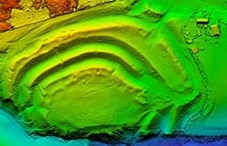
Example of Color Coded Digital Elevation Model (DEM)
- Infrastructure Inspection and Monitoring - LiDAR provides a powerful tool for inspecting critical infrastructure maintenance structures like bridges, dams, and towers. By capturing detailed 3D data, engineers can assess the structural integrity, detect deformations, and plan timely maintenance and repairs.
- Precision Agriculture and Forestry Management - 3D Scanning is invaluable in precision agriculture, providing detailed information about crop health, soil characteristics, and terrain elevations. In forestry, LiDAR aids in accurate forest inventory, allowing sustainable management practices and aiding in disaster response after forest fires or natural disasters.
- Flood Risk Assessment and Watershed Management - LiDAR assists in flood risk assessment and watershed management by accurately mapping terrain elevations and water flow patterns. This data is crucial for developing effective flood mitigation strategies and ensuring the safety of communities living in flood-prone regions.
The Advantages of LiDAR
Scanning's increasing popularity can be attributed to several distinct advantages it offers:
- High Precision and Accuracy - LiDAR provides exceptional accuracy in capturing 3D spatial data. With advanced laser technology and precise positioning systems, it can detect objects and terrain with centimeter-level precision. The data can also be combined with Terrestrial Scans.
- Rapid Data Collection - Scanning systems can quickly collect vast amounts of data over large areas in a short period. This efficiency is particularly valuable in time-sensitive applications, such as disaster response and emergency mapping, where rapid data acquisition can make a significant difference.
- Non-Intrusive Data Acquisition - One of the key benefits of LiDAR is its non-contact nature. It can capture data from a distance without physically touching the target objects or terrain, making it suitable for delicate environments and sensitive areas like cultural heritage sites or wildlife habitats.
- Integration with Other Technologies - Scanning can be easily integrated with other remote sensing technologies, such as aerial photography and hyperspectral imaging, to create comprehensive datasets for analysis and decision-making. This integration allows for a more holistic understanding of complex environments and scenarios.
LiDAR's emergence as a transformative technology has revolutionized data acquisition and analysis across diverse industries. Its ability to generate precise and comprehensive 3D representations has unlocked many applications, ranging from environmental monitoring and urban planning to archaeology and autonomous vehicles. As LiDAR technology continues to evolve, its impact on various fields grows exponentially, promising a future where the power of light reveals even more profound insights and shapes a transformed world for generations to come.
For more information about Aerial LiDAR capabilities, visit Gateway Land Survey.