Precision vs. Accuracy: What's the Difference?
Precision in land surveying refers to the consistency of measurements. If a surveyor takes several measurements of the same piece of land and all the measurements are closely aligned, then the results are said to be precise. On the other hand, accuracy denotes how close a measurement is to the true value. A survey can be precise (with consistent results) but not accurate if those results consistently deviate from the actual value.
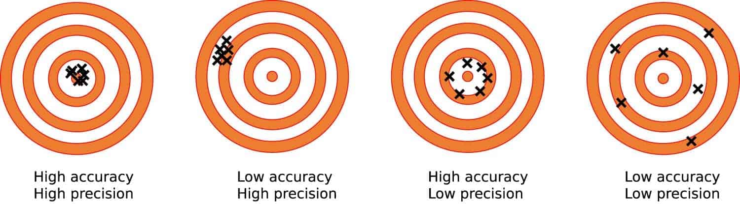
Imagine throwing darts at a dartboard. You're precise but inaccurate if all your darts cluster together but are away from the bullseye. If all your darts hit the bullseye, you're precise and accurate.
Why Both Matter in Land Surveying:
- Boundary Surveys - Determining accurate boundary lines can prevent legal disputes and assist property owners with understanding where there is neighboring or private land.
- Topographic Surveys - These surveys map the contours, elevations, and features of land surfaces. Accurate topographic surveys are crucial for drainage designs, landscaping, or any construction project to ensure compatibility with the land's natural layout. Accurate measurements will assist in land planning and development.
- Geodetic Surveys - Large areas and the curvature of the Earth affect how these surveys are completed and interpreted. Accuracy ensures that vast regions are mapped correctly, while precision provides consistent measurements over extended distances.
- Construction Surveys - Surveyors stake the land to guide construction before any building or infrastructure project begins. Both precision and accuracy here can mean the difference between a stable building and one with foundational issues.
- Hydrographic Surveys - When assessing bodies of water, precision ensures consistent depth readings, while accuracy ensures those depths are accurate to the underwater topography, critical for safe navigation and marine construction.
- Subdivision Surveys - As large parcels of land are subdivided into smaller lots, precision ensures that each lot is consistent with its specified dimensions. In contrast, accuracy provides each lot is correctly situated.
Achieving Precision and Accuracy

The Art Behind the Science
While the science of land surveying is rooted in measurements and calculations, there's an undeniable art behind achieving precision and accuracy. It's about understanding the lay of the land, interpreting what the tools convey, and applying years of training and expertise to bring forth a survey that's both reliable and dependable.
The multifaceted domain of land surveying is an intricate dance of precision and accuracy, a symphony of tools, expertise, and environmental understanding. The principles remain the same, whether it's the boundary of a new housing subdivision, the foundation of a commercial project, or the depth assessment of a marina. And it's in this consistency of principles that the magic of land surveying truly lies.